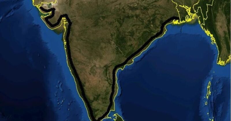
India’s coastline has been officially revised to 11,098.81 km, reflecting an increase of nearly 47% from the previous measurement of 7,561.60 km. This significant change stems from a new methodology introduced by the Ministry of Ports, Shipping, and Waterways, which utilizes modern Electronic Navigation Charts (ENCs). This approach replaces outdated mapping techniques that had been in use since the 1970s.
The reassessment, approved during a January 2024 meeting involving all coastal states, incorporates detailed coastal features such as bays and river mouths. Notably, Gujarat’s coastline nearly doubled to 2,340.62 km, making it the state with the longest shoreline. Tamil Nadu and Andhra Pradesh also saw changes, with Tamil Nadu now measuring 1,068.69 km, surpassing Andhra Pradesh’s 1,053.07 km.
The recalculation includes 1,298 offshore islands previously unaccounted for, enhancing the accuracy of India’s maritime data. The revised figures will be reviewed every decade to ensure ongoing accuracy, aiding in coastal security and infrastructure planning. This recalibration marks a pivotal shift in India’s maritime mapping, with implications for governance and environmental policy.