
Anschuetz has introduced the Generic Overlay feature, enhancing the SYNAPSIS (W)ECDIS NX by allowing seamless integration of external, geo-referenced data onto navigational charts. This capability enables third-party systems to provide overlay layers that coexist with standard navigational data, all displayed in a cohesive spatial context. Utilizing a standardized interface, external applications can connect directly to the ECDIS without any modifications, automatically adapting the system’s menus and controls to the incoming data.
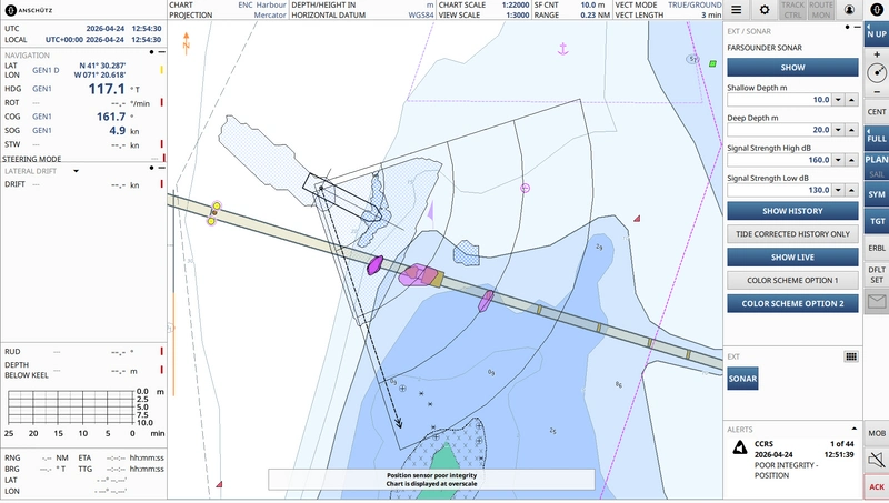
A practical application of this feature is the integration of FarSounder’s 3D forward-looking sonar into the SYNAPSIS ECDIS NX. This integration allows for real-time visualization of underwater targets and seabed structures, enhancing navigational information. Operators can distinguish between various underwater objects and seabed depths, with the system adapting visualizations based on signal strength and depth.
The Generic Overlay supports scalable integration, allowing for the easy addition of new data sources, which can be incorporated with minimal effort. This ensures a structured interface, even with multiple data layers, facilitating efficient navigation. By consolidating external sensor data within the ECDIS, operators can access relevant information directly in their navigational context, improving hazard recognition and decision-making in complex environments.


